from 1 review
24 Days
Up to 30 days
14 people
English, French


Tucked away in the rain shadow of Dhaulagiri, Upper Dolpo acts as a concealed haven, fiercely guarding its ancient Tibetan Buddhist heritage and time-honored way of life.
Far from the reach of modernity, this region draws in wanderers to traverse stark high-altitude deserts, plunge into dramatic river gorges, and wander through villages where age-old traditions still flow through daily life.
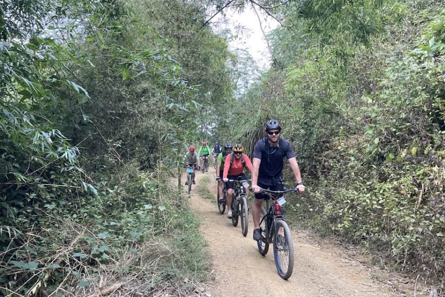
Winding through the untamed core of Shey Phoksundo National Park and over formidable mountain passes, this trek challenges even seasoned hikers.
Here, self-reliance is key, as the comforts of teahouses give way to nights under canvas and days spent far from civilization.
The vast magnitude and isolation of Upper Dolpo ensure not simply solitude but also a raw, wild splendor that rivals Nepal’s most fabled expeditions.
When you arrive in Kathmandu, our agency representative will meet you outside the Arrival gate, holding a Himalayan Exploration Treks sign. They will then take you to your hotel.
On your free day, you might visit a heritage site in the Kathmandu Valley. We will also hold a pre-trip meeting about the upcoming trek, where you can meet your guide and the rest of the team. They will explain how the team is set up, what equipment you need, what to expect during the climb, and share other important details.
The flight from Kathmandu to Nepalgunj takes about an hour, depending on the schedule. During the flight, you can see the western Himalayas, such as Langtang, Manaslu, Annapurna, and Dhaulagiri. Nepalgunj is warmer than Kathmandu and lies near the Indian border.
In the morning, you will fly to Juphal. The 45-minute flight offers sweeping views of the Himalayan foothills, including Annapurna and Dhaulagiri. After you land and gather your luggage, you will take an easy walk to Dunai.
We spend a bit more time organizing our luggage on the first day. After crossing the bridge over the Bheri River, we take the left trail to Suli ghat, the entrance to Shey Phoksundo National Park. From there, the path follows the Phoksundo Khola, passing through a few small villages before arriving at Chhepka.
The trail climbs gently through the valley and passes into the forest. The path has a few small ups and downs, and you'll cross rivers on small bridges before reaching Raichi for lunch. After Raichi, you'll see a memorable spot where two rivers of different colors join to form the Phoksundo River. From there, we continue to Chunuwar.
The first three hours of the trek are a steep climb. There is little vegetation, and the hills can be dusty during the dry season. When we reach the view tower, we see Nepal’s highest waterfall, which is 107 meters tall, along with stunning scenery all around. About 10 minutes further up the hill, we catch our first glimpse of Phoksundo Lake. From there, the trail descends gently through a pine forest to the small village of Ringmo.
Today, we will take in the beauty of Phoksundo Lake and might hike to the small village of Ringo to see its Tibetan monasteries. The people here follow the Bon Buddhist tradition, which is also called pre-Buddhist.
Ringo village marks the border between Lower and Upper Dolpo. From here, we enter the restricted Upper Dolpo area and follow the trail featured in the Oscar-nominated movie HIMALAYA, directed by Eric Valli. This path was once used for salt trading between Dolpo and Tibet. The trail becomes more adventurous as it winds along the lake. After reaching 4085 meters, it descends through dense forest, then climbs to an open valley with a stunning view of Kanjirowa Himal at 6612 meters. We finish the day at a beautiful campsite.
This part of the trek is especially scenic. You walk between tall rock walls and cross a few streams without bridges. The river flows through the gorge, and the path climbs uphill, but the slope is gentle. Along the riverbank, there are open spots with rocky ground and thorny juniper bushes.
The trail climbs steeply for the first two and a half hours, over Sandy Mountain, to Kang-La at 5350 meters. The ground is slippery, so your feet may slide with each step, and you might start to feel the effects of altitude sickness here. After descending from the pass for about four hours, you will reach Shey Gompa.
You can explore the area around Tsakang Gompa. While it is not a monastery, it serves as a retreat and has been a meditation center for many respected Tibetan lamas. Shey Gompa is part of the Chaiba community, whose members follow the Padmasambhava and Kagyu traditions. It was the first Kagyupa monastery, founded by Lama Ten-szin-Ra-Pa in the 11th century. Shey Gompa is known for its ancient Buddhist culture. In Dolpo, people combine traditional Tibetan beliefs with Buddhist teachings. Drutup Yeshe introduced Buddhism to the Dolpo Valley long ago, meeting locals who worshipped a 'fierce mountain spirit' as their main god. Crystal Mountain lies west of the Shey monastery. Its twisted cliffs are streaked with quartz and contain many marine fossils. Shey Gompa stands above the meeting point of Kwangju Nala and Yeju Nala, and you will also see a group of prayer mills powered by water wheels there.
We will cross the Shey-La pass at 5,000 meters. After the pass, the path leads over bare rocks and rough, eroded ground. From there, the trail descends to the pastures and continues toward Namgung.
We begin the day with a steep climb that feels tough as we make our way up to a 4700-meter pass. From there, we head down to the scenic village of Saldang. Saldang is one of the largest villages in the area and lies on the main trade route to Tibet.
We walk through terraced fields, stupas, chhortens, mani walls, monasteries, and several villages. The path winds through a gorge, with green barley fields below. On the way, we cross a knee-deep river twice before reaching our campsite. The campsite is in an open field, where thorny juniper bushes are the only plants.
This is the final pass of the trek, so staying mentally prepared is key. The trail begins with a leisurely walk along the river, and we cross it twice during a long stretch. The path becomes steeper near the end. As we move past the valleys and villages, we reach the barren hills and arrive at one of the highest camps on the route.
Today, we cross the final pass of our journey, following a steep uphill path. Along the way, we enjoy views of the Himalayas, including Dhaulagiri and the rugged landscape of Inner Dolpo. After the pass, the trail first descends gently, then becomes steeper as we head toward Tarap Valley. From Tokyo Goan, it takes another two hours to reach Dho-Tarap, the highest village in Dolpo and a junction where the route splits toward Jomsom, Mustang, and Tibet.
The trail descends through a winding gorge along the Tarap River. Steep ridges rise on both sides, and sometimes the path slips between or under the hills. You walk through narrow gorges with the river rushing below. Along the way, you often see mules, horses, and yaks carrying goods. In the afternoon, the trail gets easier, and you cross a modern steel bridge that makes travel simpler for both people and animals.
Follow the same path along the river toward the narrow gorge, gradually climbing through thick forest. The trail rises and falls over large rocks, so watch your step. Some areas may be slippery.
The trail is easy to follow and gently runs along the riverbank. Sometimes it climbs to the top of a hill before dropping back down to the river, leaving an open path to Dunai.
You will follow the same route back to Juphal. Walk along the road to Kala Gouda, then climb up the steep path to Juphal. Along the way, you will pass through rice fields.
We start the day with an early morning flight to Nepalgunj. The 35-minute journey offers great views of the Himalayan foothills and the main peaks, such as Annapurna and Dhaulagiri, to the north. Afterward, you take a connecting flight back to Kathmandu.
You can use this day as a backup in case your flight is delayed. If you arrive as planned, you might want to explore Kathmandu's Heritage sites.
We will arrange your transfer to the airport three hours before your flight home.
The ideal trekking seasons are from late April to early November, with May to September being most popular due to stable weather and open passes.
Upper Dolpo is considered a strenuous trek due to its remote location, high altitude (reaching over 5,000 meters), and long days of walking. Prior trekking experience and good physical fitness are highly recommended.
Yes, the Upper Dolpo region requires a special restricted area permit, a Lower Dolpo permit, and a Shey-Phoksundo National Park entry permit. Permits must be obtained through a registered trekking agency.
Most accommodation is basic, with simple teahouses or camping. Facilities are limited, so trekkers should be prepared for rustic lodging and bring necessary gear.
No, trekking independently is not allowed. Nepalese law requires trekkers to be accompanied by a registered guide and to travel in a group of at least two people in restricted areas such as Upper Dolpo.
Member Since 2024


The Untamed Heart of Nepal